blah blah blah
Mt. Paugus
Length: 8.4 miles out-and-backDifficulty (click for info): Hard
Elevation Gain: 2300 feet (+280 on return)
Rating (click for info): 7/10
Elevation: 3198'
Prominence: 978'
Driving Directions:
Trailhead and parking area are on Rt. 113A in Tamworth, NH (summit is in Albany). Rt. 113A is a loop road, and the trailhead is located on the north side of the road, 7.1 miles from the junction with 113 in North Sandwich and 6.2 miles from the junction with 113 in Tamworth. If approaching from the west (North Sandwich) direction, look for the trailhead 0.4 miles after the sharp right turn (readily noticed on maps). Park on the side of road immediately after a bridge over the Wonalancet River. Click here for a Google map.
About the Hike:
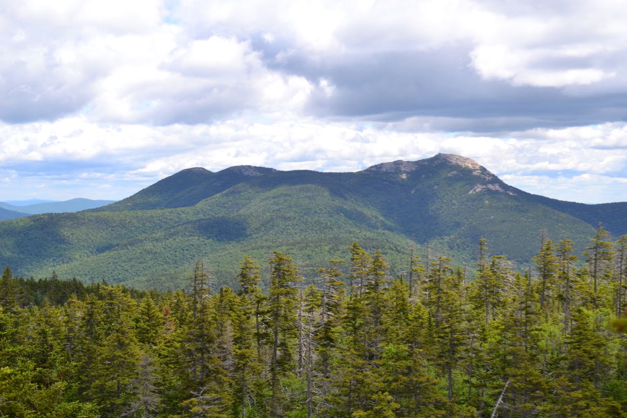
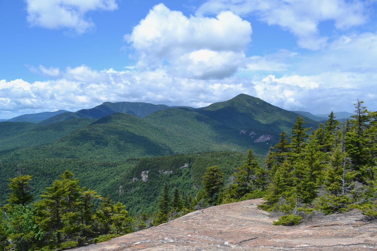
Mt. Paugus is a sizable, rugged mountain in the eastern Sandwich Range. It is located between Mt. Passaconaway and Mt. Chocorua, separated from each by notches at 2200 feet. Mt. Paugus sees far fewer visitors than its neighbors, one being among the crowd-drawing 4000-footers and the other being a poster icon for the White Mountains. Its summit, inaccessible by trail, is wide and flat, having a small, ledgy knob reached by two trails on its south side. This ledge merits its inclusion on the 52-with-a-view hiking list, as it owns a sweeping view over the Lakes Region. The easier of the two routes to Mt. Paugus, described here, is not among the most difficult White Mountain routes, but involves some steep sections, loose footing, and elevation gain on the return trip.
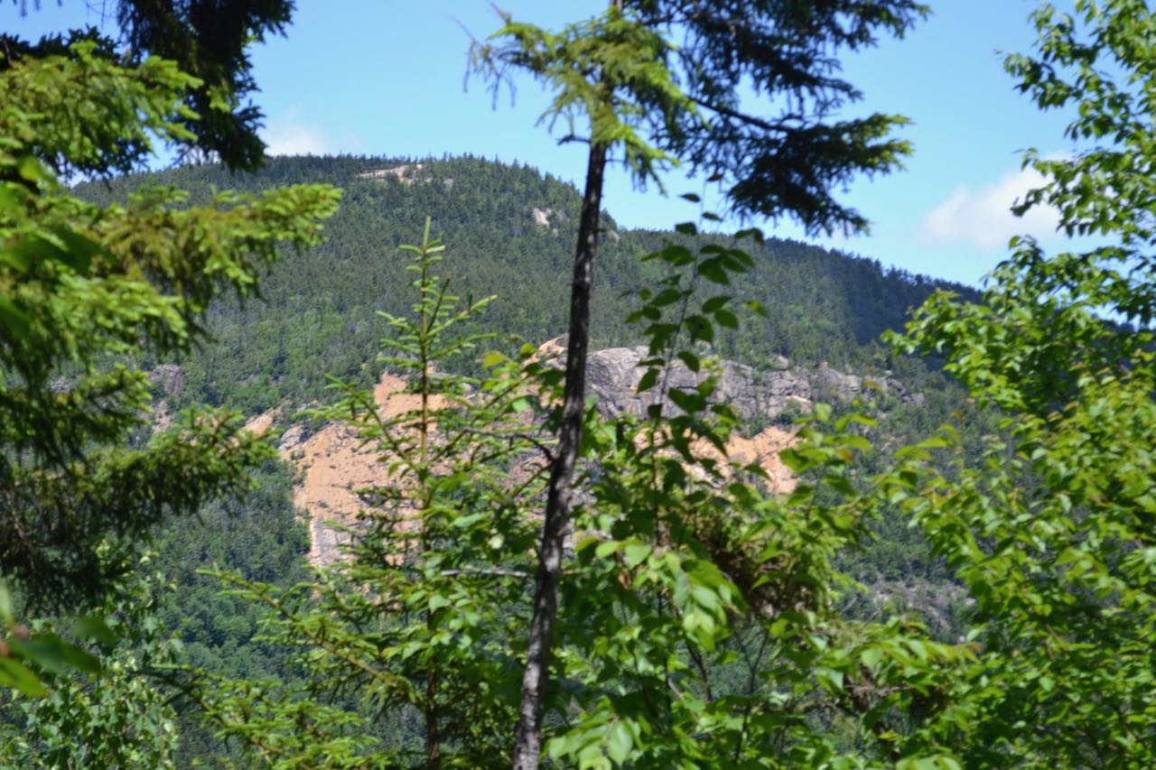
From the road, head into the woods on the wide dirt path of Cabin Trail. Follow the signs as the trail uses private roads, first bearing right, then left in the first 0.1 miles. Continue 0.2 miles to a fork, where Big Rock Cave Trail goes right. Bear left and stay on Cabin Trail as it begins an uneventful gradual climb through the forest. It starts out mostly flat, but slowly increases in grade. The trail follows an extremely straight line for this next mile, with a slight angle across the slope. A few minor brooks are crossed. In 1.4 miles from the fork at the bottom, as the trail starts to steepen more, you will enter into the Sandwich Range Wilderness. The trail climbs for 0.4 miles more to the top of a ridge rising from Mt. Mexico and crosses to the sharp slope on the other side, where Whitin Brook Trail joins from the right. Continue on Cabin Trail. The trail maintains a generally flat grade across this sharp sidehill for the next 0.2 miles, where you can peek through the trees to view the gravel slopes and cliffs on Mt. Paugus across the Whitin Brook valley. In the following 0.2 miles, the trail climbs up across the side of a knob called "Carrigain Outlook" (which has no view) and leads across another flat section to the end of Cabin Trail. You are now on the Lawrence Trail, 0.3 miles east of Paugus Pass.
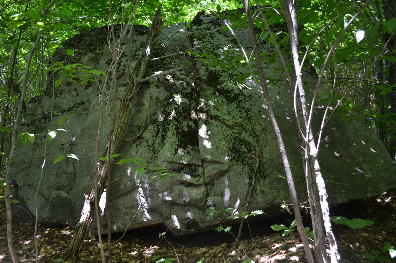
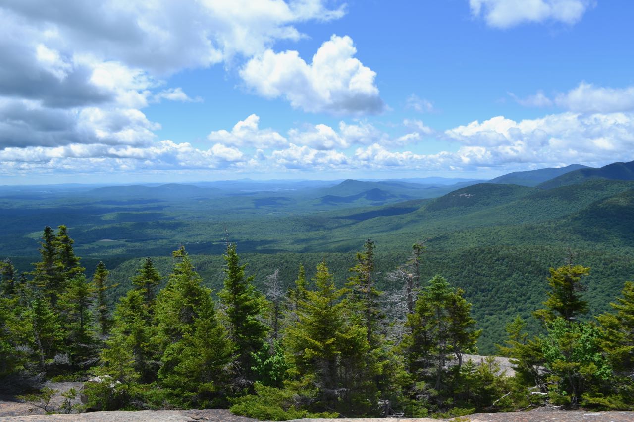
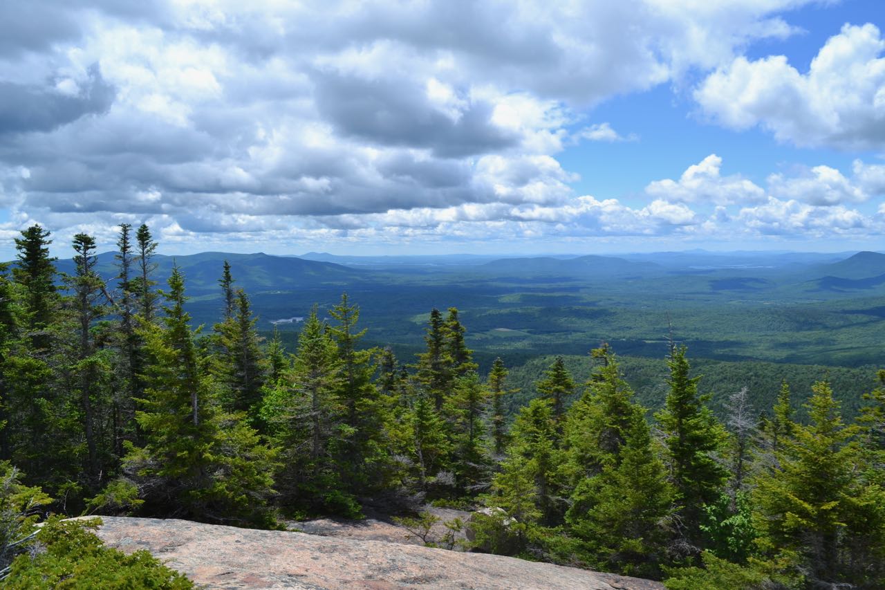
Turn right and follow the trail as it descends for 0.3 miles to skirt below cliffs on a west ridge of Paugus. In the flat sidehill section at the bottom of the descent, the trail passes many rocks and boulders. After 0.1 miles below the cliffs, the trail gradually works its way uphill again, reaching the first of many switchbacks at 0.5 miles from the last trail junction. From the first switchback, the trail ascends for a quarter mile along the side of the very top of Whitin Brook valley to a right turn. After this, the trail crosses the sources of Whitin Brook and climbs through many very short, gravelly switchbacks for the next 0.4 miles. After the last switchback, the trail climbs another 0.3 miles at moderate grades, turning away from the summit of Mt. Paugus and toward the southern knob. Lawrence Trail ends at a trail junction in the center of the large opening, where there are slight views. To find the viewpoint that claims Mt. Paugus's place on the 52-with-a-view list, you must walk downhill to the right and follow paths across the rock for a short distance to the best opening. From this point, you have a wide view of the Lakes Region. The Ossipee Range is seen through the trees to the left, with some of the Belknaps and Lake Winnipesaukee next to them. Red Hill occupies the center of the vista, with Squam Lake to its right. The Squam Range and Mt. Israel are next over, with some distant peaks to the west beyond. The main focus of the viewpoint are the three major peaks of the Sandwich Range nearby. From left to right, far to near, you can see Sandwich Dome, Mt. Whiteface, and Mt. Passaconaway. Beyond the junction at the top of the ledge, Old Paugus Trail, the other route up here, continues ahead. You can find an excellent view of Mt. Chocorua on the side of this trail about 250 feet away.
Printable directions page